ArcGIS JavaScript映射示例可帮助您快速入门。
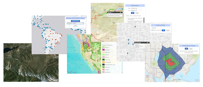
A simple set of examples that illustrate how to accomplish different mapping (and GIS) tasks with the ArcGIS API for JavaScript and ArcGIS Online Services. Also, learn how to style your apps nicely with the Bootstrap 3.x framework.
NOTE: All examples are built with Bootstrap 3.x styles. To build fully responsive maps for all devices, see Bootstrap-map-js.
NOTE: You should just be able to cut-and-paste and run the examples in JSFiddle!
<!DOCTYPE html><html><head><meta http-equiv="Content-Type" content="text/html; charset=utf-8"><meta http-equiv="X-UA-Compatible" content="IE=7,IE=9"><meta name="viewport" content="initial-scale=1, maximum-scale=1,user-scalable=no"><title>Basemaps</title><link rel="shortcut icon" href="//esri.github.io/quickstart-map-js/images/favicon.ico"><!-- ArcGIS API for JavaScript CSS--><link rel="stylesheet" href="//js.arcgis.com/3.10/js/esri/css/esri.css"><!-- Web Framework CSS - Bootstrap (getbootstrap.com) and Bootstrap-map-js (github.com/esri/bootstrap-map-js) --><link rel="stylesheet" href="//netdna.bootstrapcdn.com/bootstrap/3.1.1/css/bootstrap.min.css" rel="stylesheet"><link rel="stylesheet" href="//esri.github.io/bootstrap-map-js/src/css/bootstrapmap.css"><style>html, body, #mapDiv {height: 100%;width: 100%;}</style><!-- ArcGIS API for JavaScript library references --><script src="//js.arcgis.com/3.10compact"></script><script>require(["esri/map","dojo/on","dojo/dom","dojo/domReady!"],function(Map, on, dom) {// Create mapvar map = new Map("mapDiv",{basemap: "gray",center: [-122.69, 45.52],zoom: 3});// Wire UI Eventson(dom.byId("btnStreets"),"click", function() {map.setBasemap("streets");});on(dom.byId("btnSatellite"),"click", function() {map.setBasemap("satellite");});on(dom.byId("btnHybrid"),"click", function() {map.setBasemap("hybrid");});on(dom.byId("btnTopo"),"click", function() {map.setBasemap("topo");});on(dom.byId("btnGray"),"click", function() {map.setBasemap("gray");});on(dom.byId("btnNatGeo"),"click", function() {map.setBasemap("national-geographic");});});</script></head><body><div class="panel panel-primary panel-fixed"><div class="panel-heading"><h3 class="panel-title">Basemaps</h3></div><div class="panel-body"><div class="btn-toolbar"><div class="btn-group"><button id="btnStreets" class="btn btn-default">Streets</button><button id="btnSatellite" class="btn btn-default">Satellite</button><button id="btnHybrid" class="btn btn-default">Hybrid</button><button id="btnTopo" class="btn btn-default">Topo</button></div></div><div class="btn-toolbar"><div class="btn-group"><button id="btnGray" class="btn btn-default">Gray</button><button id="btnNatGeo" class="btn btn-default">National Geographic</button></div></div></div></div><div id="mapDiv"></div></body></html>
Bootstrap 3.x: Web Framework CSS
//netdna.bootstrapcdn.com/bootstrap/3.1.1/css/bootstrap.min.css
Bootstrap-map-js: Map, Popup and Dijit CSS
//esri.github.io/bootstrap-map-js/src/css/bootstrapmap.css
Find a bug or want to request a new feature? Please let us know by submitting an issue. Thank you!
Anyone and everyone is welcome to contribute. Please see our guidelines for contributing.
Copyright 2013 Esri
Licensed under the Apache License, Version 2.0 (the “License”);
you may not use this file except in compliance with the License.
You may obtain a copy of the License at
http://www.apache.org/licenses/LICENSE-2.0
Unless required by applicable law or agreed to in writing, software
distributed under the License is distributed on an “AS IS” BASIS,
WITHOUT WARRANTIES OR CONDITIONS OF ANY KIND, either express or implied.
See the License for the specific language governing permissions and
limitations under the License.
A copy of the license is available in the repository’s license.txt file.