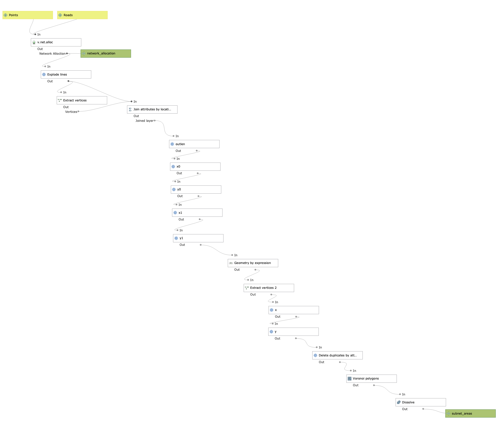
A QGIS model/algorithm that computes areas closest to points based on a road network.
Input points and roads in the same co-ordinate system and get a resulting areas layer which represents closest areas to the points based on drive time (currently doesn’t incorporate road speed).
Mainly relies on GRASS algorithm v.net.alloc which does a network allocation (allocates roads to closest points) essentially creating subnetworks. These subnetworks are then used to create areas, hence this model’s name “Subnet Areas”.
Methodology: https://github.com/mattmarotta/QGIS-Subnet-Areas/blob/master/methodology.md

https://gis.stackexchange.com/questions/209419/how-to-compute-areas-of-influence-in-qgis
I originally posted this question which led to this methodology.
https://gis.stackexchange.com/questions/297002/programmatically-changing-line-lengths-in-qgis
Helped with how to change line lengths.
The final calculation in the link above did not work so I found this worked instead.
https://gis.stackexchange.com/questions/94493/unable-to-select-float-precision-when-adding-column
I could not for the life of me figure out why I couldn’t change the precision in the field calculator. Turns out geopackages store precison as floating whereas it has to be explicitly defined for shapefiles I was used to working with.
https://gis.stackexchange.com/questions/310148/pyqgis-processing-memory-not-found
When I tried to run this model as a python script, it would just fail very early on using v.net.alloc. Confirms that grass in python cannot output to temporary layer. It also must be output to a permanent file when running the model file.
This model may crash qgis and I couldn’t figure out why. Running it from the processing toolbox solves this.